Canals, Pumps and Reclaimed Land in the Po Plain
An examination of the bonifica infrastructure that transformed waterlogged lowlands into productive farmland across the Po Valley between the mid-nineteenth and mid-twentieth centuries.
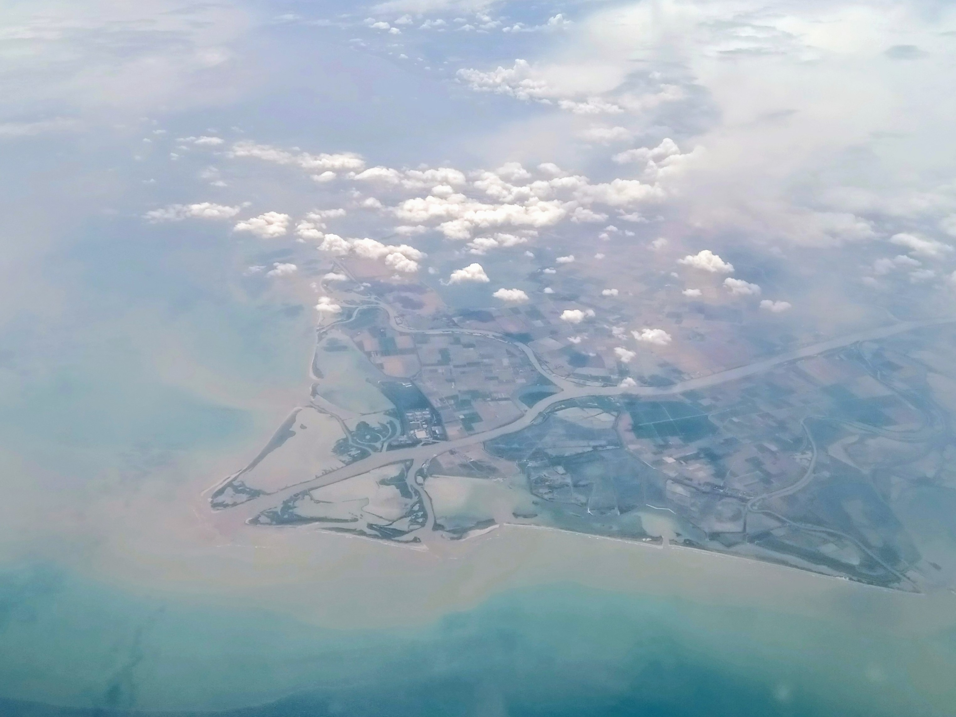
Po River delta, Adriatic coast. The dense network of drainage channels and reclaimed fields is visible from the air. © Wikimedia Commons
Latest Articles
Topics Covered
The three articles below address distinct aspects of the bonifica system: its canal engineering, the mechanical pump stations that sustained it, and the longer political and agrarian history behind the reclamation effort.

Bonifica Canals of the Po Valley
How the network of artificial waterways was planned, excavated and maintained across the low-lying Po Plain to control flooding and enable cultivation.

Pump Stations of Emilia-Romagna
The idrovore — mechanical lifting stations driven first by steam then by electricity — that raised subsurface water into outlet canals and kept the reclaimed land dry.

Land Reclamation in the Pianura Padana
From papal land grants in the sixteenth century to the large-scale state-directed bonifica integrale programmes of the early twentieth century.
The Po Plain
A Lowland Shaped by Water Management
The Pianura Padana — the broad alluvial plain drained by the Po and its tributaries — occupies roughly 46,000 km² of northern Italy. For most of its length it lies only a few metres above sea level, and in parts of Ferrara, Rovigo and the Veneto the surface drops below mean sea level.
Before systematic drainage, large areas were occupied by shallow lakes, marshes, and seasonal floodplains. The bonifica effort, accelerating dramatically from the 1860s onward, converted much of this territory into cultivated land by means of an engineered canal system combined with mechanical lifting stations.
The transformation was never simply technical. It required negotiation between landowners, municipal authorities, regional consortia and, from the 1920s, the central government — each with different interests in how water was managed and who bore the cost.
Key Topics
Areas of Focus
The Ferrarese Lowlands
The province of Ferrara contains some of the most extensively reclaimed territory in Italy. Much of its northern half sits below sea level and depends entirely on continuous mechanical pumping to remain cultivable.
Canal Consortia
The Consorzi di bonifica — regional drainage consortia — were the institutional backbone of Po Valley reclamation. They coordinated maintenance, apportioned costs and managed the relation between private landholding and shared hydraulic infrastructure.
Bonifica Integrale
The 1933 Baccarini Law and subsequent legislation gave the Italian state authority to direct and subsidise large-scale reclamation. The programme combined hydraulic works with agricultural improvement and road construction across the same territory.
Contact
Send an Inquiry
For questions about the content of this site or to flag factual corrections, use the form below. All fields are required.